Korlai Fort
Alibaug is a renowned place, well known for the beautiful beach and the fort named Colaba. To the south of Alibaug is the town of “Revdanda”, which was one of the most important centers of the Portuguese in 15th and 16th century. A further southward is the fort of Korlai, which is quite beautiful. It is surrounded by sea on three sides.
It is not a tall fort. The total height is about 275 m. The most fascinating one is the beach here. The blue ocean on one side and the creek named “Kundalika” on the eastern end create scenery. The fort is situated at the mouth of the creek and has been admired by great historians like Pandit Mahadevshastri Joshi. Some important incidents are linked with the fort and need to recall. Moreover, its construction is also a good one.
Type : Coastal Forts
Fort Range : Konkan
District : Raigad
History :
An account of significant event contributes to the great history of the fort. In 1521, Portuguese had established a strong control over the coast, and took permission from the first Burhan Nizam. They erected a port over here, and built a machi here. Korlai was initially known as the “Rock of Chaul”. Here they set a strong control by controlling fort of Revdanda. In 1594, there was a chaotic situation after Burhan Nizam died. The Portuguese tried to take advantage of this by building fortification here. But Hussein Nizam perceived the danger and decided to fortify this mountain himself. The Portuguese opposed this and they signed a treaty. It was decided that inseam would not build a fort and the Portuguese would not pose him any threat on the seas. However second Burhan Nizam succeeded in building a fort here.
Once his Sardar Fattekhan cannoned the walls of Revdanda. The Portuguese were short of soldiers, and ordered more men. They then attacked the fort by pervading in the base village. They won the fight and captured Korlai. In 1602, a garrison of 8000 was present on the fort. Thus it was clear that the Portuguese had to involve a considerable part of their army to protect this place. Hence they maintained the citadel, the ramparts, storage house and the machi, demolishing the remaining work. In 1684, Sambhaji Maharaj made an unsuccessful attempt to capture the fort. In 1739, Chimajiappa made a strong attack on the fort and captured it. The Marathas changed the names of bastions. San Diyago was named Pushti and San Francisco was named Ganesh. Finally it became a part of independent India.
Fascinating Spots :
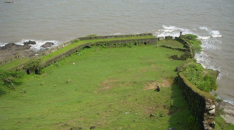
Let us start our trek from the first entrance. We come on the citadel that is about 100 m long and just 10m wide. The ramparts are in a good condition. There is an old church. From here we can have a glimpse of the blue waters, which gives a sense of the blue sky mixed with the seawater. The small boats sailing look amazing. Going westwards there are 2 bastions, the one on seaside is called San Diyago and the one on the creek side is called San Francisco. In all there are five bastions.
As we descend down through the seven doorways, we reach the western front where the storehouse for ammunition is present. On the western and northern ends cannons were stationed, pointing towards the sea and the fort of Revdanda respectively. It has been discovered that there were 70 cannons on the fort in 1602.
On the northern end is a machi, on which a cross was erected and is called “Santa Cruz”. It is 3 m high and cannons stood here guarding the northern end.
Ways To Reach :
One has to board a bus to Revdanda. From here we get auto-rickshaw to the village of Korlai. It takes 20 minutes to reach to the base of the fort. There are 2 ways:
The entrance from the southern face or seaside is the way of stairs. A walk of 25 minutes leads us to the top, or the citadel of the fort.
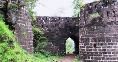
The entrance on northwestern side is to be reached by walking all around the northern periphery of the fort. This entrance faces the west side and leads to the citadel after passing seven doors.
