Mahuli Fort
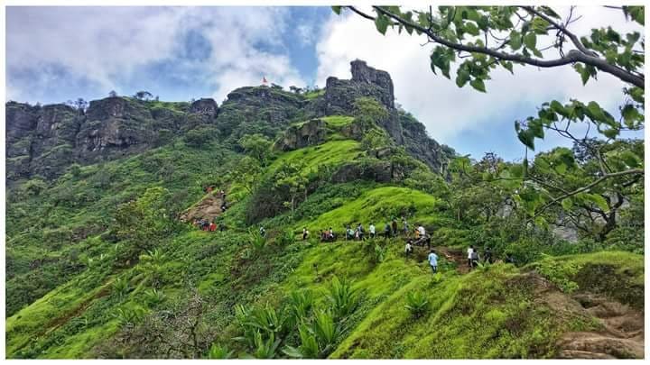
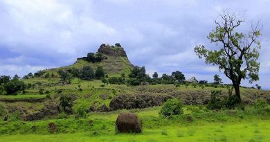
Information:- In Thane district near Shahpur-Asangaon we find a group of three mountains – Mahuli, Bhandargad and Palasgad. Here the nature is so pleasant that we must visit this place to see the natural beauty. The mountain with many pinnacles is known as Mahuli. Mahuli is divided into three parts – northern one is Palasgad, Mahuli in the middle and Bhandargad on the southern end.
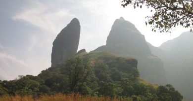
At 2815 ft., this is a popular trekking destination and a paradise for rock-climbers because of many nearby pinnacles with interesting names like Vazir, Vishnu, etc., given by the local trekking and climbing fraternity. This mountain complex is actually a group of two or more hills with common cols and pinnacles.
It is the highest point in the Thane district. The forest surrounding Mahuli has been declared as a sanctuary. Once Shahaji Raje, father of Chatrapati Shivaji Maharaj, had this fortress under his belt. The forst has been declared as a protected monument.
Besides an open Shiva temple there is a small perennial drinking water cistern on top, three caves of which the larger can be used as overnight shelter, like as on many other such natural hill forts of Maharashtra Western Ghats (Sahyadri Range). There is a stone arch historically known as the ‘Kalyan Darwaja’ but the dome of the arch is now broken.
Extra Places To Visit:- From Asangaon we reach the eastern side of the fort. Here we have to climb a ladder. Here we see two water cisterns. After 5 minutes walk, another cistern is seen. At the top we come across a diversion. Way to the left goes to Bhandargad. At the right side gatehouses are seen. Further we see the ruins of Mahadarwaza. The way from cistern goes to Palasgad. On the way there is a bamboo forest. From here, Alang, Madan, Kulang and Kalsubai are seen and on the east Harishchandragad, Aajobagad are seen. To the southeast Matheran range and to southwest, Tansa and Tungareshwar range can be seen. Further from ladder way, a way at left side goes to a forest. Here we see Mahadeo temple. Next to it are the remnants of a palace. Opposite to it is a big lake. Then we reach Jamoon bag. This way takes us at a ridge. This ridge falls between Bhandargad and Mahuli. At the right side, 500 to 600 ft down, near the pinnacle Kalyan Darwaza is seen. We can come from Kalyan Darwaaja to the fort by rock climbing. After ascending the ridge, we come near a hidden cistern. The way further takes us at Bhandargad.
From Bhandargad we can locate pinnacles of Bhatoba and Navara & Navari. The surrounding scenery is very beautiful.
Type:- Hill Fort
Fort Range:- Shahapur
District:- Thane
Height Above Sea Level:- 2815ft
Difficulty Rating:- Easy
Base Village:- Mahuli
App Time To Reach Top:- 2 hours from Asangaon
Water Availability:- Water is available in reservoirs in front of gatehouses at Mahuli. No water is available on Bhandargad.
Food:- One should arrange for the foodstuffs.
Shelter:- No accommodation is available on Bhandargad. The gatehouses at Mahuli can accommodate a few people. However it is better to complete the trek within one whole day.
Best Time To Visit:- Any time
How To Reach:- Via Asangaon :
Asangaon is on Mumbai-Nasik rail route. From Asangaon station by walking or by auto we reach at Mahuli gaon. It is 5 km away from Asangaon station. At the base of the fort we see a very beautiful Mahadev temple. One can spend a night here. From here at the right side, after crossing a small water flow, and climbing for 3 km further, we reach at the fort. From this way we have to go by a ladder. After crossing it there are two water reservoirs.
Via Vasind :
Alight at Vasind by bus or local train. Then go at north for Duhagaon and then ‘Charyacha Pada’. Keeping Chanderi to right, one has to ascend the western trunk of Mahuli. This way is quite difficult. We reach at Kalyan Darwaaja and proceed to the top of Bhandargad. There is a lithograph on this entrance.
To get a close-up view of the many curiously shaped pinnacles from behind the fort, alight at Vasind Railway Station, go about 5 to 7 km on a narrow road keeping the mountain to your right. Go behind the fort, preferably with a local villager’s help, reach a remote place in the forest locally called ‘Ambyache Paani’ (water at the mango tree). Water here is present throughout the year; one may have to dig the soil to reach water in the earth in the summer months from end-March to mid-June. For those venturing among the pinnacles, be wary of the numerous beehives hanging from overhangs on the vertical cliffs.


